


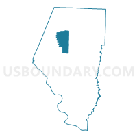
Voting District 14, Boone County, Missouri
About
Outline

Summary
| Unique Area Identifier | 607136 |
| Name | Voting District 14 |
| County | Boone County |
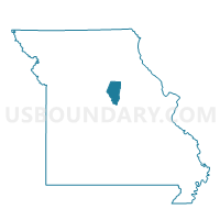
| State | Missouri |
| Area (square miles) | 23.36 |
| Land Area (square miles) | 23.25 |
| Water Area (square miles) | 0.11 |
| % of Land Area | 99.52 |
| % of Water Area | 0.48 |
| Latitude of the Internal Point | 39.08064570 |
| Longtitude of the Internal Point | -92.35783300 |
Maps

Graphs
Select a template below for downloading or customizing gragh for Voting District 14, Boone County, Missouri


Neighbors
Neighoring Voting District (by Name) Neighboring Voting District on the Map
- Voting District 07, Boone County, MO
- Voting District 15, Boone County, MO
- Voting District 20, Boone County, MO
- Voting District 22, Boone County, MO
Top 10 Neighboring County Subdivision (by Population) Neighboring County Subdivision on the Map
- Missouri township, Boone County, MO (58,199)
- Rocky Fork township, Boone County, MO (8,397)
- Perche township, Boone County, MO (4,079)